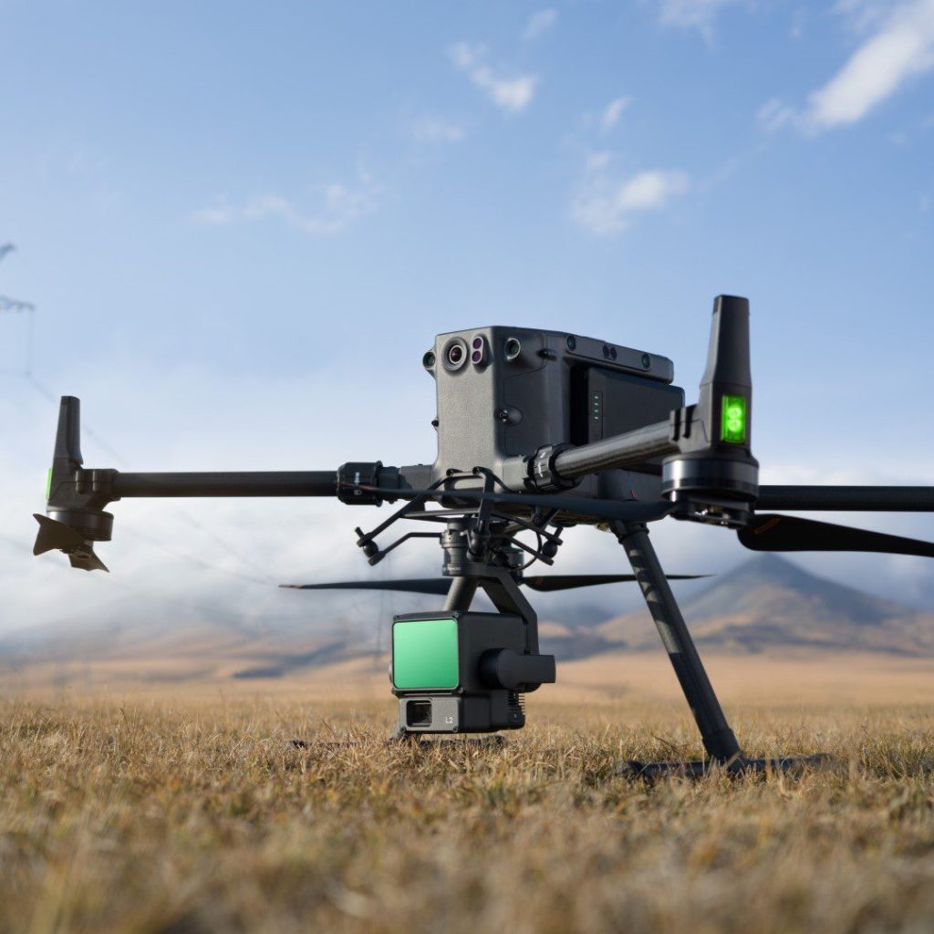
DJI have announced the brand-new Mavic 3 Multispectral (Mavic 3M), a specialist drone specifically for agricultural surveying and product management.
Monitoring and managing agricultural landscapes can be a challenge due to their often significant expanse. Collecting and processing the data required to make informed decisions can be a serious strain on human resource, and without the right technology at hand, opportunities for improvement can be missed.
Part of the new Mavic 3 Enterprise series of compact commercial drones, the DJI Mavic 3M is the go-to tool to provide smart aerial perspective to agricultural management operations. Mavic 3M has a compact form factor, which makes it quick to get in the air and easy to carry.
Agricultural users can use their Mavic 3M to gather precise data to aid agricultural decision making. The drone has two forms of sight; by combining an RGB camera with a multispectral camera that analyses agricultural terrain with total clarity, an agricultural site or landscape can be viewed from the air like never before.
Mavic 3M is also a highly reliable drone with efficient, ultra-long battery performance. It can cruise for up to 43 minutes – enough time to map up to 200 hectares of land – and has fast-charging functionality which can facilitate multiple operations in a day. Because of its compact form factor, Mavic 3M can easily be carried in its rugged yet ergonomic carry case. The drone can be deployed with ease and without complicated setup, and its safety while in the air is optimised thanks to omnidirectional obstacle avoidance technology.
Mavic 3 Multispectral can add value in key agricultural operations, including the following.
Orchard mapping
Even on sloped landscapes, Mavic 3M can perform terrain-follow aerial surveying of orchards and similar sites. Highly accurate, high resolution 3D digital reconstructions can be produced via DJI Terra or DJI SmartFarm, allowing surveyors to identify key metrics and other structures.
Guide variable rate applications
Multispectral images of crops can be useful for applications like rice fertilisation or potato fertilisation. Multispectral imaging can be used to monitor stunted growth and can be easily and efficiently resolved using DJI’s Terra or SmartFarm applications. Deploying a drone to capture accurate, relevant data such as crop growth rate can significantly aid decision-making and is a cost-effective way of monitoring land to identify cost saving opportunities to protect the environment.
Intelligent field scouting
Intelligent field scouting, the process of analysing land using smart technology to identify abnormalities and agricultural opportunities, can be achieved with Mavic 3M with DJI Terra or SmartFarm. Applications include features like identifying weed pressure and deficiencies, and using a drone can allow one person to manage up to 70 hectares of farmland independently.
Environmental monitoring and surveying

Mavic 3M is the ideal solution for cost-effective and highly accurate environmental monitoring and resource surveying. Applications like water enrichment monitoring, forest surveying and urban area surveying can be achieved time-efficiently, delivering vital information to teams to aid decision-making.
If you are a drone operator or a drone reseller and you’re interested in Mavic 3 Multispectral, speak to our DJI Brand Manager and drone operations specialist Andrew Bird today on 01489 287 287 or andrew.bird@syndico.net.
Syndico is proud to be DJI’s exclusive UK Enterprise distributor – for more information on the DJI Enterprise range, please visit syndico.net/dji/.